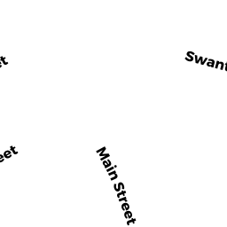
15 MCKAY AV
Owner Information
WINCHESTER TOWN OF
71 MT VERNON STREET
WINCHESTER, MA 01890


Property Details
15 MCKAY AV is classified as a (formerly Municipalities/Districts. Removed June 2009.) (Util bldg).
The primary structure on this property was built in 1960. There are 4,972ft2 of built area within this property. There is 4,972ft2 of residential/living space within this property. There are 2 units within this property.
15 MCKAY AV is valued at $1,061,400. The land is valued at $661,300 and the structures are valued at $398,500. There is an additional valuation of $1,600 on this property.
This property is in Zone SCI. Confirm with local Zoning Board authorities to ensure there are no overlays or other easements on this property.
15 MCKAY AV was last sold on Wednesday, February 6, 1963 for $0.
Assessment data from fiscal year 2021.
Flood Data
This property is partially within the AE Zone (within floodplain). Approximately 0.02 acres (0.2%) of the property is within this zone.
A portion of this property is denoted as being within a floodway.
This information is sourced from the FEMA National Flood Hazard Layer. See our full disclamer.
Broadband Internet Providers
| Provider | Type | Bandwidth (mbps) | |
|---|---|---|---|
| Verizon New England Inc. | DSL | 10 | 1 |
| Viasat Inc | Satellite | 100 | 3 |
| Crown Castle Fiber | Fiber | 0 | 0 |
| VSAT Systems, LLC. | Satellite | 2 | 1 |
| HughesNet | Satellite | 25 | 3 |
| GCI Communication Corp. | Satellite | 0 | 0 |
| Comcast | Cable | 1000 | 35 |
| Verizon New England Inc. | Fiber | 940 | 880 |
Broadband service provider data from December 2020.
Adjacent Properties
- 0 MCKAY AV
Parking Lots - a commercial open parking lot for motor vehicles owned by 7 MCKAY AVENUE LLC - 7 MCKAY AV
Office Building - part of manufacturing operation owned by 7 MCKAY AVENUE LLC - 171 U 33 SWANTON ST
Residential Condominium owned by KAPER VALERY + IRINA BOSSINZON - 171 U 34 SWANTON ST
Residential Condominium owned by ZHU TONGGE - 171 U 35 SWANTON ST
Residential Condominium owned by FASS DANIEL+CHIALIN CHENG - 171 U 36 SWANTON ST
Residential Condominium owned by DOHERTY DEBORAH J TRUST - 171 U 37 SWANTON ST
Residential Condominium owned by GU YANG + LUJING SHEN - 171 U 38 SWANTON ST
Residential Condominium owned by TSE LAUREN A - 171 U 39 SWANTON ST
Residential Condominium owned by GE ZHONGYANG + QIONGHUA WENG - 171 U 41 SWANTON ST
Residential Condominium owned by LILIYA GOLDSHMID - 171 U 42 SWANTON ST
Residential Condominium owned by DEBUERIIS ALBERT N REVOCABLE TRUST - 171 U 43 SWANTON ST
Residential Condominium owned by YANG XU + XI CHEN - 171 U 44 SWANTON ST
Residential Condominium owned by SHEAN HELEN E - 171 U 45 SWANTON ST
Residential Condominium owned by SUN FRANCES - 171 U 46 SWANTON ST
Residential Condominium owned by JIN BO + YUYAN DUAN - 171 U 47 SWANTON ST
Residential Condominium owned by DEVLIN DENNIS M - 171 U 48 SWANTON ST
Residential Condominium owned by CORDEIRO JOANNE REVOCABLE TRUST - 171 U 49 SWANTON ST
Residential Condominium owned by FAN JIEYU + BEI YE - 171 U 50 SWANTON ST
Residential Condominium owned by PARKER SHIRLEY J - 171 U 20 SWANTON ST
Residential Condominium owned by MEEHAN JANE C - 171 U 51 SWANTON ST
Residential Condominium owned by WS REVOCABLE LIVING TRUST - 171 U 52 SWANTON ST
Residential Condominium owned by BRAMAN VIRGINIA M REVOCABLE TRUST - 171 U 53 SWANTON ST
Residential Condominium owned by MACLEOD MARILYN L REVOCABLE TRUST - 171 U 54 SWANTON ST
Residential Condominium owned by NASSON ALEXANDER A JR - 171 U 55 SWANTON ST
Residential Condominium owned by LUO LING + ZHENGHUI JIANG - 171 U 56 SWANTON ST
Residential Condominium owned by DOUCETTE DIANE M - 171 U 57 SWANTON ST
Residential Condominium owned by LENNON JOHN - 171 U 58 SWANTON ST
Residential Condominium owned by HOSHMAND LISA LAI-SANG TRUST - 171 U 59 SWANTON ST
Residential Condominium owned by REILLY FAMILY NOMINEE TRUST - 171 U 60 SWANTON ST
Residential Condominium owned by EHRLICH SCOTT R + SIVAN R - 171 U 61 SWANTON ST
Residential Condominium owned by ELLIS ANDREW + GISELE - 171 U 62 SWANTON ST
Residential Condominium owned by WU BEI + CHEN ZHU - 171 U 63 SWANTON ST
Residential Condominium owned by KENT REALTY TRUST - 171 U 64 SWANTON ST
Residential Condominium owned by ZHANG HAOSHENG + SU - 171 U 65 SWANTON ST
Residential Condominium owned by SANDLER LAURA L - 171 U 66 SWANTON ST
Residential Condominium owned by PARK JI SEOK + JOOMIN YEON - 171 U 67 SWANTON ST
Residential Condominium owned by MCGILLICUDDY FAMILY IRREVOCABLE TR - 171 U 68 SWANTON ST
Residential Condominium owned by CHIEN CHENG-LIN + SZU-HSIN OU - 171 U 70 SWANTON ST
Residential Condominium owned by ZHANG NING L + NING - 171 U 71 SWANTON ST
Residential Condominium owned by KHABIRY MASOUD + MARYAM SHOKRI - 171 U 72 SWANTON ST
Residential Condominium owned by TIAN JIAO - 171 U 73 SWANTON ST
Residential Condominium owned by PAPILE GLORIA L - 171 U 74 SWANTON ST
Residential Condominium owned by WEI JINGQIANG + HAN ZHANG - 171 U 1 SWANTON ST
Residential Condominium owned by LI XI + LI ZHAO - 171 U 2 SWANTON ST
Residential Condominium owned by LEE JAMES E - 171 U 3 SWANTON ST
Residential Condominium owned by WHITE COLIN A - 171 U 4 SWANTON ST
Residential Condominium owned by 171 SWANTON NO 4 NOMINEE TRUST - 171 U 5 SWANTON ST
Residential Condominium owned by IYER RAJU K + ALICE C - 171 U 6 SWANTON ST
Residential Condominium owned by DISARCINA ANNE M REV LIV TRUST - 171 U 8 SWANTON ST
Residential Condominium owned by OBRIEN JANE - 171 U 9 SWANTON ST
Residential Condominium owned by ROCHE M THERESE - 171 U 10 SWANTON ST
Residential Condominium owned by NICHOLSON NANCY M - 171 U 11 SWANTON ST
Residential Condominium owned by ZHANG HAIFENG + JIN HU - 171 U 12 SWANTON ST
Residential Condominium owned by SUSAN GOLDBERG REVOCABLE TRUST - 171 U 13 SWANTON ST
Residential Condominium owned by GALANTE ADOLPH J HEIRS OF - 171 U 14 SWANTON ST
Residential Condominium owned by CARLSON MELBA R - 171 U 15 SWANTON ST
Residential Condominium owned by BRATT STEVEN R + AMY STERLING - 171 U 16 SWANTON ST
Residential Condominium owned by MCANENY PAMELA - 171 U 17 SWANTON ST
Residential Condominium owned by SULLIVAN ROSEMARY FAMILY TR - 171 U 18 SWANTON ST
Residential Condominium owned by ONEIL MARTHA E - 171 U 21 SWANTON ST
Residential Condominium owned by LOPEZ ARLENE G - 171 U 75 SWANTON ST
Residential Condominium owned by LIU QING HUA + ZHEN XIE - 171 U 76 SWANTON ST
Residential Condominium owned by KRUSZELNICKI JACEK ET AL - 171 U 77 SWANTON ST
Residential Condominium owned by GLADSTONE STEVEN J + KIM D - 171 U 78 SWANTON ST
Residential Condominium owned by TIMILSINIA SANJAYA - 171 U 79 SWANTON ST
Residential Condominium owned by ELRAYES SHAKER TAHER - 171 U 80 SWANTON ST
Residential Condominium owned by FERRARA LISA M - 171 U 22 SWANTON ST
Residential Condominium owned by NAGAR FAMILY REVOCABLE TRUST - 171 U 23 SWANTON ST
Residential Condominium owned by HEALY WILLIAM - 171 U 24 SWANTON ST
Residential Condominium owned by NAHILL EDITH - 171 U 25 SWANTON ST
Residential Condominium owned by LIU SHANG + XIANGYUN XIAO - 171 U 26 SWANTON ST
Residential Condominium owned by SHIRASAKI MASATAKA + KIMIE - 171 U 27 SWANTON ST
Residential Condominium owned by MCNULTY DANIEL E - 171 U 28 SWANTON ST
Residential Condominium owned by TAI GEORGE - 171 U 30 SWANTON ST
Residential Condominium owned by MARYANSKI SHEILA - 171 U 31 SWANTON ST
Residential Condominium owned by ZHOU HUI + WEI LI - 171 U 32 SWANTON ST
Residential Condominium owned by CHROSTOWSKI JAMES W - 171 U 69 SWANTON ST
Residential Condominium owned by TAYLOR BENJAMIN - 171 U 7 SWANTON ST
Residential Condominium owned by CHANG JOHNNY + SUJIN LEE - 171 U 19 SWANTON ST
Residential Condominium owned by SCHLOSSBERG DANIEL R - 171 U 29 SWANTON ST
Residential Condominium owned by HERRMANN ROBERT L + JANET R - 171 U 40 SWANTON ST
Residential Condominium owned by YU HUNG-CHI + FENG-LI